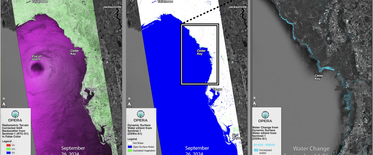
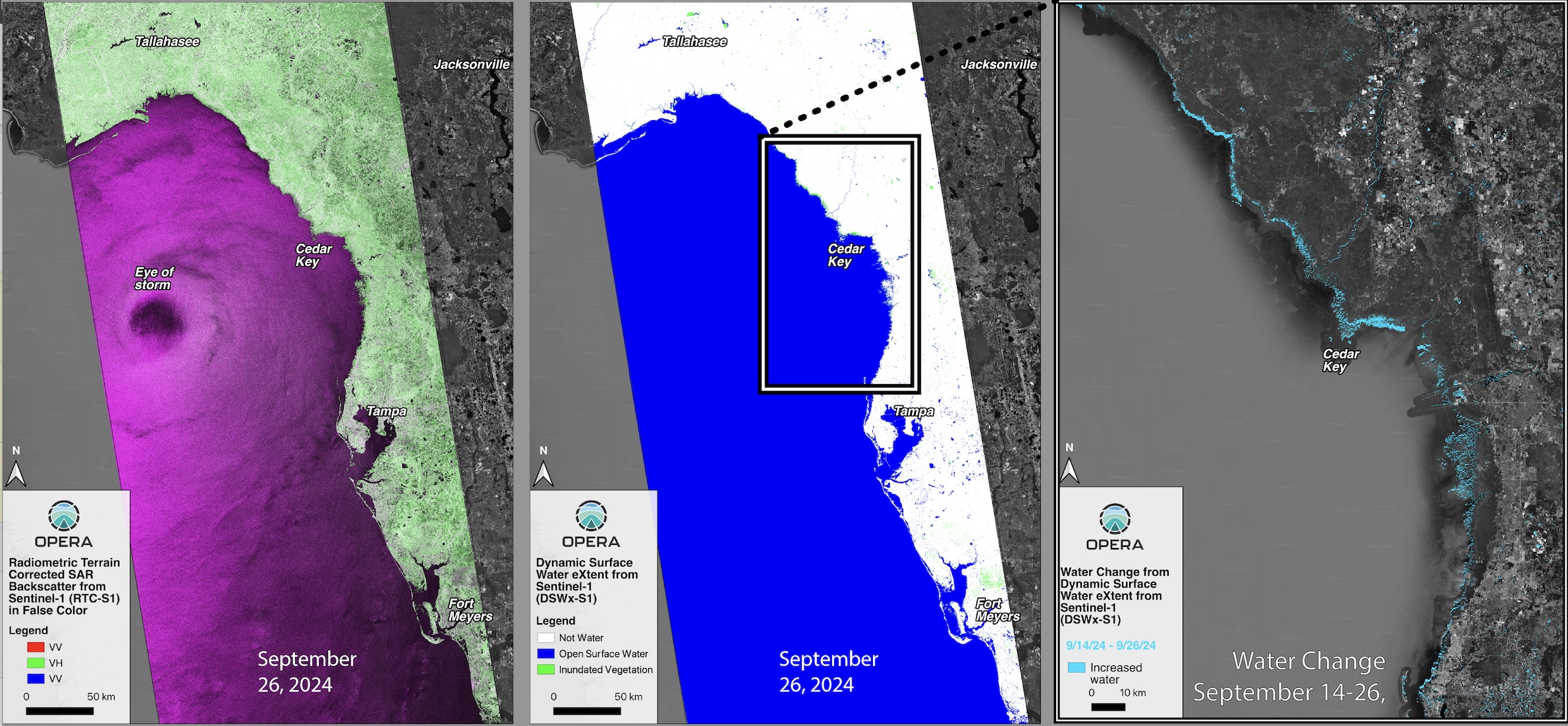
On September 26, 2024, Hurricane Helene made landfall in the Big Bend area of the Florida Gulf Coast as a Category 4 storm1, causing coastal flooding from 15 feet of storm surge2. Coastal and inland flood records were broken; for example, in Tampa Bay, one gauge recorded a water surge 7 feet above the normal high tide, with all of the area’s gauges breaking the recent local records3.
When natural disasters occur, the NASA Disaster Response Coordination System (DRCS)4 works to deliver data to stakeholders that can be used to guide decision-making. At NASA’s Jet Propulsion Laboratory (JPL), the Advanced Rapid Imaging and Analysis (ARIA) and Observational Products for End-Users from Remote Sensing (OPERA) projects frequently work with the DRCS to provide remote sensing imagery to support the disaster response efforts. OPERA systematically produces a suite of analysis-ready surface water extent data products that are useful for mapping inundation (and other surface water needs), which are available at PO.DAAC, and are derived from synthetic aperture radar (SAR) and optical data sources. These satellite data products are designed to meet the needs of U.S. Federal Agencies identified by the Satellite Needs Working Group5.
For the Hurricane Helene disaster response, the ARIA/OPERA team provided value-added radar and optical remote sensing datasets that were generated by the OPERA project. The team provided several disaster response datasets, including mosaicked OPERA Radiometric Terrain Corrected SAR backscatter from Sentinel-1 (RTC-S1) products (Figure 1, left), mosaicked OPERA Dynamic Surface Water eXtent from Sentinel-1 (DSWx-S1 data product) (Figure 1, center), and water change maps. Coastal inundation from the storm surge was mapped by differencing two DSWx-S1 images, one from September 14, 2024 before the storm and the other from September 26, 2024 after the storm (Figure 1, right). SAR-based water products have the key advantage of being able to ‘see’ water and the ground surface day or night and through cloud cover, which is particularly important during storms.
OPERA also produces a Dynamic Surface Water eXtent product from another data source, Harmonized Landsat Sentinel-2 (DSWx-HLS) optical data. The DSWx-HLS optical imagery has a higher temporal resolution and provides water maps on the same grid and with similar water classifications. However, depending on the event, cloud cover can often hinder the full usefulness of this type of data, as was the case with Hurricane Helene. The OPERA DSWx-HLS data can be further explored using NASA Worldview. All of OPERA’s Surface Water products are hosted at NASA’s PO.DAAC.