
The study underscores SWOT’s potential to provide two-dimensional estimates of sea ice thickness—essential to quantify exchanges between sea ice, the atmosphere, and the ocean, which current altimeters cannot provide. SWOT sea ice measurements can also support applications that demand greater spatial coverage and more frequent sampling, including process studies, seasonal forecasting, and navigation.
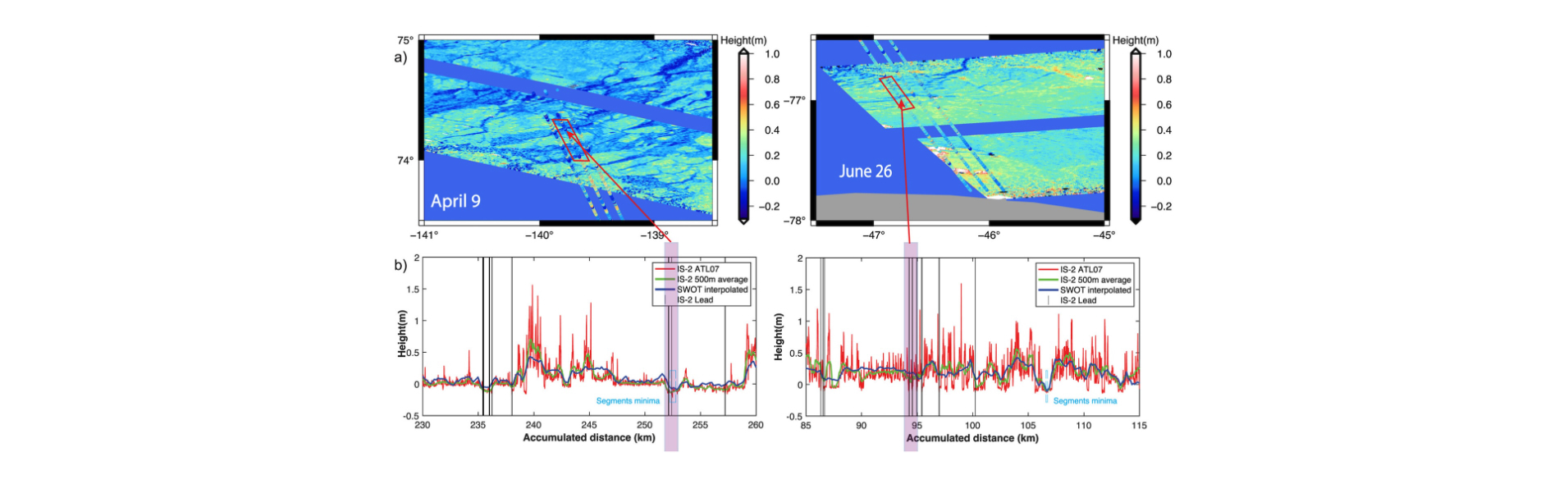
Figure: Comparison of SWOT and ICESat-2 surface heights: (a) Maps showing the location and heights of SWOT (swath) and ICESat-2 (dots) superposed, on April 9 in the Arctic (left) and June 26 in the Antarctic (right); (b) Along-track surface height profiles from ICESat-2 (native resolution in red and 500-m averages green) and SWOT (blue). The purple shaded areas highlight regions of identified leads captured by ICESat-2 and SWOT. Source: Kacimi et al., 20254